Exumas weather for boaters: trade winds, cold fronts, swell and hurricane season
Exumas boating weather: hurricane season dates, how each source describes the trade winds, and how a cold front and its swell show up in a Bahamas Met bulletin.
For Exumas boating, Atlantic hurricane season runs 1 June to 30 November, and the National Hurricane Center puts its peak at 10 September1. The Moorings describes trade winds averaging 10 to 20 knots3. A front shows up in the swell: Bahamas Met's 17 October 2026 statement forecast Atlantic-side seas of 7 to 11 feet with local winds of only 10 to 15 knots2.
- At a glance
- Hurricane season
- 1 June to 30 November1
- Peak of the season
- 10 September, per the NHC1
- Trade winds, The Moorings charter page
- Averaging 10 to 20 knots3
- Trade winds, The Moorings eGuide
- Around 10 to 15 knots, almost continually6
- Seas on 17 Oct 2026 bulletin
- 7 to 11 ft, Atlantic exposures, Mon to Tue2
- Emergency VHF
- Channel 16, monitored 24 hours4
On this page
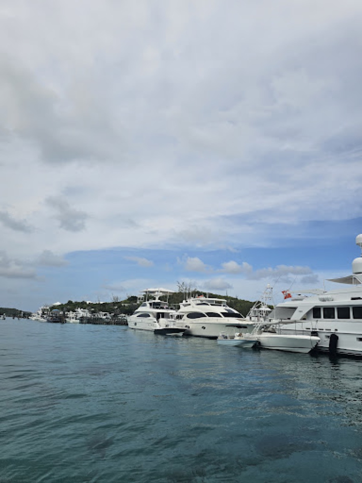
Weather decides when you move in the Exumas. This page gives the hurricane season dates, how each source describes the trade winds, and one dated Bahamas Met bulletin that shows how a front and its swell are forecast. It is part of the boating guide.
When is hurricane season in the Exumas?
The Atlantic hurricane season runs from 1 June to 30 November1. The first named storm typically forms in mid to late June, and the first hurricane tends to form in early to mid-August1. The National Hurricane Center puts the peak of the season at 10 September, with most activity between mid-August and mid-October1. Its average Atlantic season has 14 named storms, 7 hurricanes and 3 major hurricanes1. Wikipedia notes that although the season officially lasts from June to November, most hurricanes in the Bahamas occur between July and October5.
For a boat trip, the dates matter more than the averages. A trip that falls inside the window should have a plan for where the boat goes if a storm is forecast, and a way to leave early. If you are weighing cover for a trip inside the window, read travel insurance for a Bahamas boat trip before you pay a deposit.
What are the usual winds for sailing the Exumas?
Each source describes the trade winds in its own words, so here they are separately.
- The Moorings charter page: steady trade winds, averaging 10 to 20 knots3.
- The Moorings eGuide: the northern trade winds (E to ENE) blow around 10 to 15 knots almost continually throughout The Bahamas6.
- Wikipedia: winds are predominantly easterly throughout the year, tending to become northeasterly from October to April and southeasterly from May to September, and they seldom exceed 24 km/h except during hurricane season5.
Treat these as general descriptions, not a month-by-month forecast. A bulletin like the one below is what tells you to change the plan.
What does the weather do through the year?
Wikipedia describes a wet season from May through October, dominated by warm, moist tropical air, and a dry season from November through April, when a mix of drier northeast trade winds and occasional westerlies coming down from the North American mainland affect the Bahamas5. Rain often comes as short, fairly intense thundershowers with strong gusty winds, followed by a return to clear skies5.
The Moorings eGuide says the most refreshing time is December through February, when the temperature averages 70 to 75 degrees F6. It says mid spring starts the rainy season in the form of local thunderstorms and squalls, usually in the afternoon, and that some produce waterspouts, so keep a lookout6. For the month-by-month view of crowds and conditions, read the best time to visit the Exumas.
How does a cold front show up in a Bahamas forecast?
The Bahamas Department of Meteorology issued a special weather statement on a cold front at 6 PM EDT on Saturday 17 October 20262. Its headline read large northeast swells and hazardous marine conditions through midweek7. The table pulls out what the statement said.
| Forecast element | What Bahamas Met said |
|---|---|
| Front | Stalls near the Straits of Florida and Northern Bahamas on Monday, then weakens by midweek2 |
| Wind behind the front | Strong northeasterlies over the Gulf Stream, with large northeasterly swells into Bahamian waters from Sunday through Wednesday2 |
| Swell in the Exumas | Reaches Cat Island, San Salvador, Long Island and the Exumas on Sunday night and Monday2 |
| Seas, Atlantic exposures | 7 to 11 feet in the Central and Southeast Bahamas, Monday through Tuesday2 |
| Local wind | Only 10 to 15 knots2 |
The front was forecast to stall near the Straits of Florida and the Northern Bahamas, yet the swell behind it was forecast to spread to the Exumas2.
Can the seas be rough when the wind is light?
Yes. The most useful line in that bulletin is the gap between wind and seas. Atlantic exposures were forecast at 7 to 11 feet while local winds stayed at only 10 to 15 knots2. Read both numbers every time. For how water behaves in the cuts, see the cuts and tides guide.
Bahamas Met advised small craft operators in the Central and Southeast Bahamas to stay in port or in sheltered waters from Monday through Tuesday2. If a forecast like that covers your area, a day in a protected anchorage costs you less than a bad crossing.
How do you make a go or no-go call?
Check the Bahamas Met marine forecast and any special weather statement before each leg, not only at the start of the trip. Look for a front, then for swell direction and size, then for the wind. The bulletin above went out on Saturday evening and put the swell in the Exumas by Sunday night2, so read statements as they come out, not once a day. Plan the exposed legs for the calm days and keep the shelter days free.
Crossing from Florida adds the Gulf Stream, where wind and current interact; see Florida to the Exumas by boat. On the water, the Bahamas National Trust says Channel 16 is monitored 24 hours a day for emergencies4. Call “Exuma Park” on Channel 09 for the park office, though it sits on a remote island and can be hard to reach4. The VHF channel guide covers the rest. For choosing a route between the banks, see Exuma Bank vs Exuma Sound.
These pages are not a substitute for charts, forecasts and local knowledge.
Read next
Best time to visit the Exumas: weather, hurricane season and events
When to go to the Exumas: the November to April dry season, the June to November hurricane season, Nassau rain and temperature by month, and April's regatta.
planTravel insurance for a Bahamas boat trip: what the CDC, DAN, BoatUS and Markel say
Travel insurance for a Bahamas boat trip: what the CDC, DAN, BoatUS, Markel and The Moorings say about evacuation, towing, named storms and charter waivers.
boatingExuma cuts and tides: slack water, swell and when to run a cut
How to run an Exuma cut: tidal range, slack water, why swell matters more than wind, a Bahamas Met swell warning and the VHF channels to call.
Questions people ask
When is hurricane season in the Exumas?
The Atlantic hurricane season runs from 1 June to 30 November1. The first named storm typically forms in mid to late June and the first hurricane in early to mid-August1. Wikipedia adds that most hurricanes in the Bahamas occur between July and October5.
What are the usual winds for sailing the Exumas?
The Moorings charter page describes steady trade winds averaging 10 to 20 knots3, while its eGuide describes northern trade winds blowing around 10 to 15 knots almost continually6. Wikipedia says winds are predominantly easterly, northeasterly from October to April and southeasterly from May to September5. Read the current forecast before each leg.
Can the seas be rough when the wind is light?
Yes. Bahamas Met forecast seas of 7 to 11 feet on Atlantic exposures of the Central and Southeast Bahamas on 17 October 2026, even though local winds were only 10 to 15 knots2.
Should small boats go out when a swell arrives?
In that same bulletin, Bahamas Met told small craft operators in the Central and Southeast Bahamas to stay in port or in sheltered water from Monday through Tuesday2. Follow the bulletin for your own dates.
What is the best month for Exumas boating weather?
Wikipedia gives the Bahamian dry season as November through April5, and The Moorings calls December through February the most refreshing time, with temperatures averaging 70 to 75 degrees F6. The Atlantic hurricane season runs 1 June to 30 November1. See the best time to visit guide for the full picture.
Sources (7)
- Atlantic and Eastern Pacific Hurricane Season (NHC climatology)GOV
US National Hurricane Center (NOAA) · nhc.noaa.gov · checked 2026-10-18 - Special Weather Statement, cold front update, issued 6 PM EDT Sat 17 Oct 2026 (PDF)GOV
Bahamas Department of Meteorology · met.gov.bs · checked 2026-10-18 - Exumas Yacht Charters & Sailing VacationsOPERATOR
The Moorings · moorings.com · checked 2026-10-18 - Exuma Cays Land & Sea ParkBNT
Bahamas National Trust · bnt.bs · checked 2026-10-18 - Climate of the Bahamas (Wikipedia)
Wikipedia · en.wikipedia.org · checked 2026-10-19 - The Moorings Exumas eGuide 2026 (PDF)OPERATOR
The Moorings · assets.moorings.com · checked 2026-10-19 - Bahamas Department of Meteorology home page (special weather statement headline, 17 Oct 2026)GOV
Bahamas Department of Meteorology · met.gov.bs · checked 2026-10-19
Photo credits (2)

Park fees and rules come from the Bahamas National Trust or the Bahamas government; check them again before you go. How we check facts.