Lee Stocking Island, Exuma: the old marine research station, trails and anchorages
Lee Stocking Island in the Exumas hosted a NOAA-linked marine research facility from 1984 to 2012. Location, stromatolites, trails and anchorages.
Lee Stocking Island is in the Exuma district of the Bahamas, at 23.7721°N, 76.0998°W1. It hosted a marine research facility from 1984 to 2012, connected to NOAA1. It lies south of Exuma Cays Land & Sea Park, whose southern corners are at 24°14′25″N and 24°18′37″N4. It is a different island from Stocking Island, also in Exuma1.
- At a glance
- Coordinates
- 23.7721°N, 76.0998°W1
- Research facility
- 1984 to 2012, connected to NOAA1
- Offshore feature
- Stromatolites1
- Trail to Perry's Peak
- About 15 minutes one way, per a 2022 blog3
- Not to be confused with
- Stocking Island, also in Exuma1
- Inside Exuma Park?
- No, south of the park's southern corners4
On this page
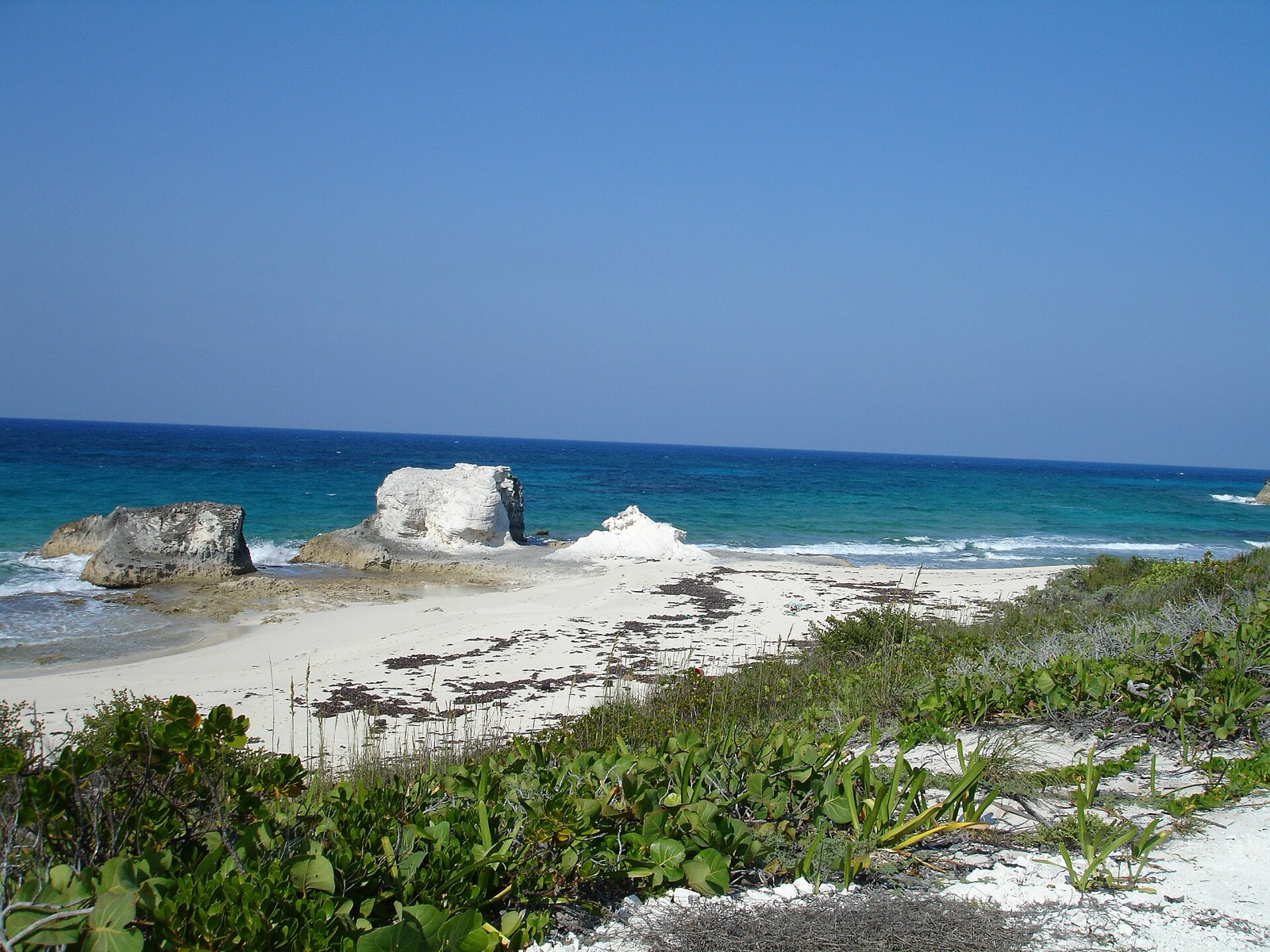
Lee Stocking Island is in the Exuma district of the Bahamas1. It is not to be confused with Stocking Island, also in Exuma1. The places guide lists the other Exuma stops.
Where is Lee Stocking Island?
The island lies at 23.7721°N, 76.0998°W1. That is south of the Exuma Cays Land & Sea Park: the Bahamas National Trust gives the park’s two southern boundary corners as 24°14′25″N and 24°18′37″N4. The park vs wider Exumas guide shows how to read that comparison.
What is the Lee Stocking research station?
The island hosted a marine research facility from 1984 to 2012, connected to NOAA1. The NOAA Miami Regional Library keeps a selective bibliography of work done there2. Titles in it include:
- A 1987 University of Miami study of the environments and sediments of Lee Stocking Island2.
- A 1993 Caribbean Marine Research Center workshop on pathogens and parasites of reef corals, held at the island2.
- A 1995 patch reef study of Rainbow Gardens Reef2.
- A 1993 study of coral bleaching at the island in 19902.
- A 1989 American Geophysical Union field trip guide to giant subtidal stromatolites and related sedimentary features2.
Stromatolites are found offshore of the island1.
What can you do on Lee Stocking Island?
A cruising blog written in 2022 describes the island from the water and the trails. Its crew reports these details3:
- The island narrows to less than 100 meters wide3.
- A hiking trail leads up to the airstrip and the research center3. Hiking to and exploring the research center and back took about three hours3.
- Perry’s Peak is about fifteen minutes one way from the trail3.
- Another trail runs south along the ocean-side cliffs3.
- A big beach is popular for hiking and beach activities3.
The blog calls the abandoned research facility the big highlight of the island. Maintenance crew seemed to be roaming around the facility, and the blog suggests looking for the hyperbaric chamber3. The facility has several docks that provide easier access than the hike, but the blog’s crew experienced a lot of current at the research center anchorage3.
Where do boats anchor at Lee Stocking?
The blog’s favorite anchorage in the Lee Stocking area is Williams Bay3. It is excellent for sea glass, and a fantastic location for beach sunsets3. The north west side of the island has a bit of a wrapping swell at anchor3. Check current charts and local advice before you anchor, because the blog is dated 13 July 20223. For other Exuma anchorages, see the George Town and Elizabeth Harbour guide.
Read next
Stocking Island, Exuma: beaches, snorkeling and getting there from George Town
Stocking Island sits 1 mile across the harbor from George Town, Exuma: how to get there, Chat 'n' Chill hours, snorkeling, the Beacon and where to stay.
boatingGeorge Town and Elizabeth Harbour: anchoring, docking and Stocking Island
George Town, Great Exuma and Elizabeth Harbour for boaters: where boats anchor, the Exuma Yacht Club marina, Lake Victoria dinghy dock and Stocking Island.
parkIs Pig Beach in Exuma Park? What is inside the park and what is not
Pig Beach, Staniel Cay and Great Exuma all sit outside Exuma Cays Land & Sea Park. See the coordinates, the park's extent and what else the Exumas protect.
Questions people ask
What was Lee Stocking Island used for?
The island hosted a marine research facility from 1984 to 2012, connected to NOAA1. The NOAA Miami Regional Library keeps a selective bibliography on Lee Stocking Island, covering studies of its sediments, reef corals and stromatolites2.
Is Lee Stocking Island the same as Stocking Island?
No. Wikipedia notes that Lee Stocking Island is not to be confused with Stocking Island, which is also in Exuma1. The separate Stocking Island guide covers that island.
Is Lee Stocking Island inside Exuma Cays Land & Sea Park?
No. The island lies at 23.7721°N1, south of the park's two southern boundary corners at 24°14′25″N and 24°18′37″N4.
What can you see at the Lee Stocking research facility?
A 2022 cruising blog calls the abandoned research facility the big highlight of the island and suggests looking for the hyperbaric chamber3. The facility has several docks, and a hiking trail leads up to the airstrip and the research center3. The blog is dated 13 July 2022, so conditions may have changed.
Sources (4)
- Lee Stocking Island (Wikipedia)
Wikipedia · en.wikipedia.org · checked 2026-10-19 - Lee Stocking Island, Exuma, Bahamas: Selective BibliographyGOV
NOAA Miami Regional Library · aoml.noaa.gov · checked 2026-10-19 - Lee Stocking, Exumas (13 July 2022)
Out Chasing Stars · outchasingstars.com · checked 2026-10-19 - Exuma Cays Land & Sea ParkBNT
Bahamas National Trust · bnt.bs · checked 2026-10-18
Photo credits (2)


Park fees and rules come from the Bahamas National Trust or the Bahamas government; check them again before you go. How we check facts.